Archaeological Observation, Bristol
Border Archaeology was instructed to carry out a programme of Archaeological Observation at York Road, Bristol.

In Brief
Archaeological Observation (Watching brief)
Location: BristolKey Points
- Bedminster lies within the floodplain of the Malago and is largely flat, although flanked by hills and escarpments. No archaeological evidence for Iron Age or prehistoric activity has been recovered within the investigation area and no archaeological records relating to Roman activity have been identified in the immediate locality of York Road, although it should be noted that relatively little archaeological fieldwork has been undertaken in this area.
- Cartographic evidence suggests that the site probably formed part of a large, triangular plot of land that was bisected by the construction of the railway line in the mid 19th century.
Summary
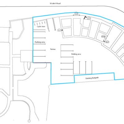
Archaeological Observation (Watching Brief) of ground works relating to a proposed development to include 10 apartments and associated car parking on land to the rear of York Road, Bristol. Wall foundations were encountered beneath the levelling material and these are considered to represent a terrace of early 20th -century dwellings built shortly after 1902 and shown on the Ordnance Survey 3rd edition 1918 along the southwest extent of St Luke’s Road. The results of the ground works observation suggest that the likelihood of encountering earlier structural remains is low based on the intensive nature of development activity on the site.
- The archaeological programme of work related to the construction of 10 apartments on land to the rear York Road, Bristo.
- The engineering ground works comprised continuous foundation trenching which attained depths of 0.73- 3.2m to reflect variations in ground levels across the site.
- An extensive demolition layer was revealed across the entire site overlain by a sequence of modern levelling layers beneath a car park surface.
- Wall foundations were encountered beneath the levelling material and these are considered to represent a terrace of early 20th –century dwellings built shortly after 1902 and shown on the Ordnance Survey 3rd edition 1918 along the southwest extent of St Luke’s Road.
- The results of the ground works observation suggest that the likelihood of encountering earlier structural remains is low based on the intensive nature of development activity on the site.
- Natural geology was not encountered during the course of the ground works excavations.
Results
It would appear likely that intensive early 20th -century redevelopment activity had truncated much of the evidence relating to earlier building foundations and that the majority of the structural remains encountered during the course of the engineering ground works related to the terraced housing shown within the study area on the Ordnance Survey 3rd edition plan of 1918.
A number of demolition deposits were also encountered across the site potentially relating to mid-late 19th development.
The results of the ground works excavations suggest the survival of masonry and foundations relating to properties predating the 20th century may be quite limited due to the extensive re-development of this area. However, in view of the fact that natural geology was not encountered, it is not possible to determine the extent to which earlier archaeological deposits and features may survive.

