Archaeological Observation, Sevenoaks, Kent
We were commissioned by South East Water as part of the Solefields Main Reinforcement Scheme, Sevenoaks, Kent to undertake an archaeological programme of work in relation to the installation of 3.037km of pipeline.
In Brief
Archaeological Desk-Based Assessment
Archaeological Observation on Geotechnical Boreholes
Archaeological Heritage Statement
Archaeological Walkover Survey
Archaeological Written Scheme of Investigation
Archaeological Watching Brief (Archaeological Observation)
Key Points
- A total of 3.037km of pipeline monitored; predominantly laid using Horizontal Directional Drilling Techniques and open-cut trenching
- 2.1km of pipeline monitored through the historic Grade 1 Registered Knole Park
- Natural soil and bedrock deposits encountered c. 1.8-2.0m below existing ground level
- Features and finds of Prehistoric, Roman, and Post-Medieval date encountered
Summary
The pipeline commenced from a connection point at the junction of Dartford Road (A225) and Avenue Road, crossing Seal Hollow Road (B2019) to enter Knole Park. Within the grounds of Knole Park, the pipeline route extended for approximately 2.1km though a dry valley running north-south through the western half of the park, exiting the park adjacent to Tonbridge Road, reaching its terminus at Solefields No. 1 Service Reservoir on the west side of Tonbridge Road.
An Archaeological Desk-based Assessment (ADBA) was undertaken for the entirety of the scheme. A Heritage Statement (HS), a walkover survey, and geotechnical borehole survey were conducted following the route of the pipeline corridor through Knole Park as part of a pre-assessment programme of works, in full agreement and consultation with the National Trust. This was followed by a programme of Archaeological Observation (AO).
Results
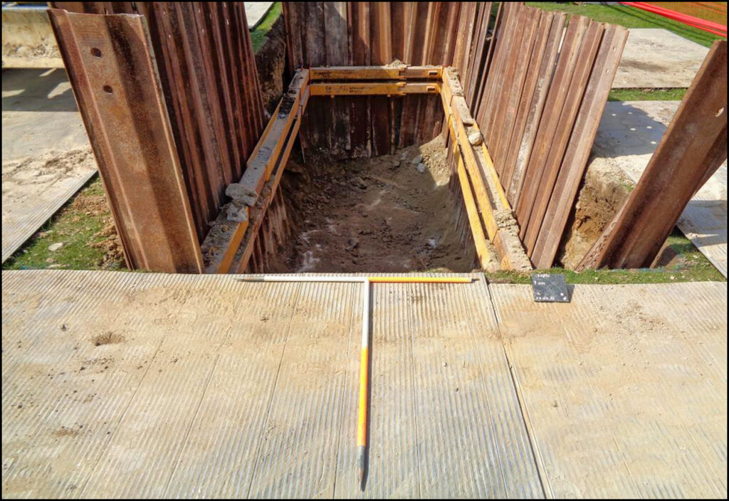
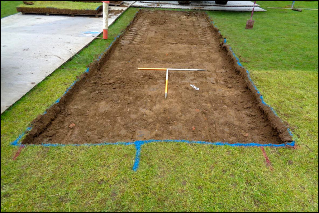
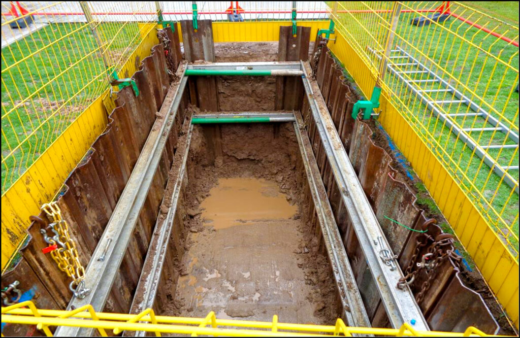
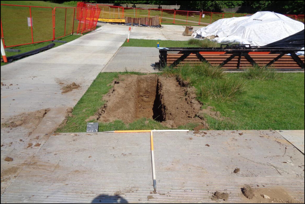
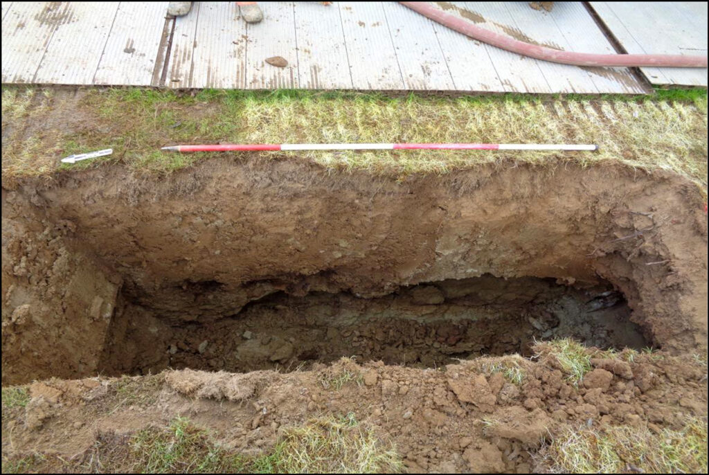
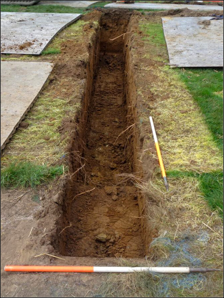
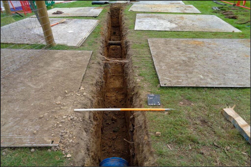
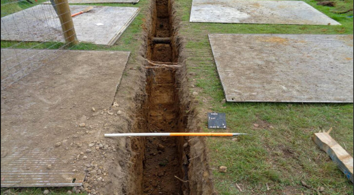
Fifty-seven trenches were recorded along the pipeline corridor. Horizontal Directional Drilling was the primary method of pipeline installation, selected to avoid extensive ground disturbance within the pipeline corridor running through Knole Park. Open-cut trenching was employed for associated launch/receptor, connection and pressure relief pits, trial pits and the sections of pipeline within the roadways.
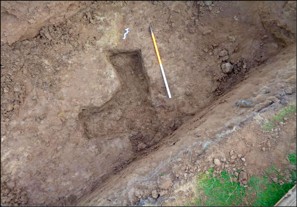
Archaeological features encountered included two foundation trenches, two post-holes, and two gully features truncated by a pit.
In the vicinity of Seal Hollow Road, a post-hole was revealed which may be associated with a property located adjacent to the pipeline corridor, portrayed on Andrew and Drury’s Map of Kent dated to 1769, though absent on the subsequent 1798 Ordnance Survey map.
Within Knole Park a foundation trench recorded may represent the remains of a Roman or later dated structure based on the building material and form of the feature, though no dating evidence was recovered. Centrally along the route within the park a possible post-hole was recorded, though it is possible that this feature is representative of natural rooting activity. Two gullies and a pit were also revealed close by. One of the gullies corresponded with a linear feature interpreted as part of an agricultural field system of Late Prehistoric/Romano-British date identified in a field study undertaken by Dr. A. Oswald, University of York. The pit, having cut both gullies, is later, though could be near contemporary in date. No datable material was recovered from any of the three features.
At the S extent of the route within Knole Park and bordering Tonbridge Road was the remains of a trench- built wall/footing relating to a structure of Post-Medieval date.
Topsoil finds from the programme of works included pottery, ceramic building material (CBM), animal bone, glass, and clay tobacco pipes (CTP). A representative sample was retained. Notable topsoil finds included a fragment of a rotary quernstone and a Victorian penny whilst a single undated undiagnostic modified flint flake was the only recorded find recovered from a colluvium deposit.