Eastern and Western Expansion, Milton Keynes
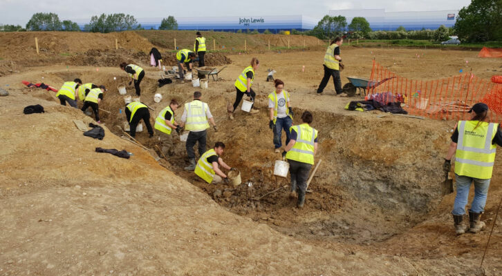
Ancient Milton Keynes came under the archaeological spotlight between 2012 and 2020 when the company investigated more than two million square metres of farmland earmarked by the council for commercial and residential development.
In Brief
Archaeological Evaluation
Archaeological Excavation
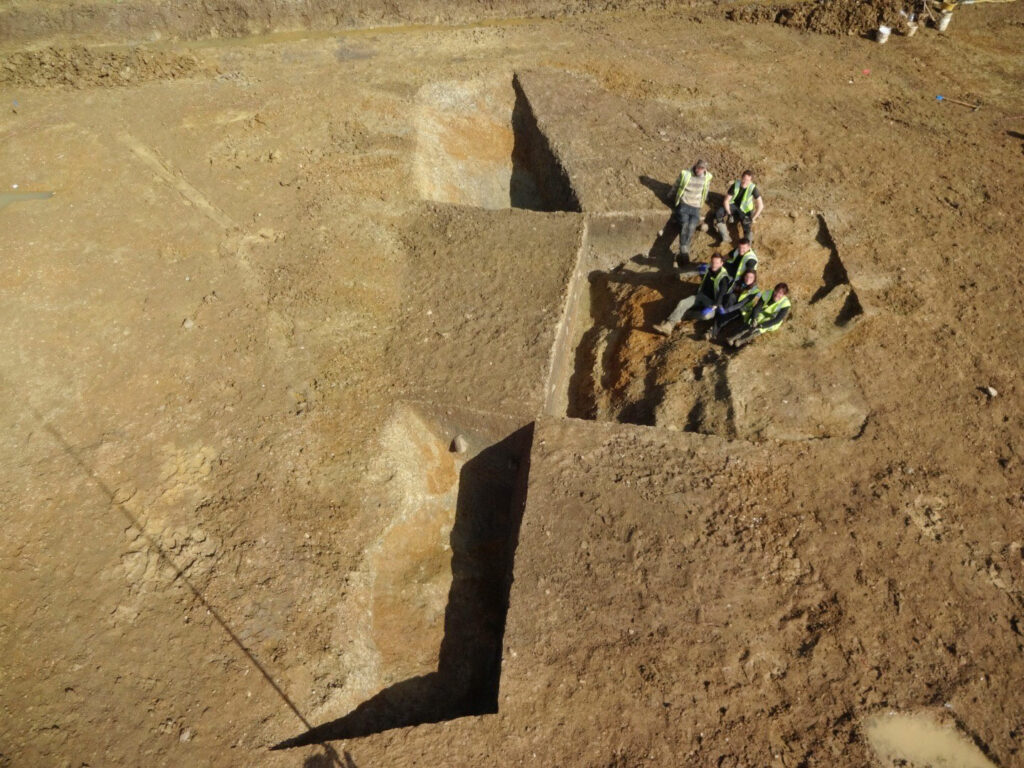
Drone Survey
Palaeoenvironmental Assessment
Key Points
- Ancient Milton Keynes came under the archaeological spotlight between 2012 and 2020 when the company investigated more than two million square metres of farmland
- The largest single archaeological project undertaken in or around the modern city of MK
- We were one of the first archaeological companies to set up in MK, followed by a slew of competitors
- Much of the evidence unearthed related to Iron Age and Roman occupation and cast very significant light on this key transitional period
Summary
In what amounted to the largest single archaeological project undertaken in or around the modern city, our client – a leading UK strategic land company – handed us management responsibility for two council designated urban expansion areas, the MK Western (WEA) and Eastern (EEA) Expansion Areas, respectively, which included individual sites of up to 500,000 square metres.
With a team of archaeologists based permanently in the city and often battling against the worst inclement weather in a century, the company was able to assume additional responsibility for managing site logistics and directing infrastructure works, including the installation of some 14km of haul roads.
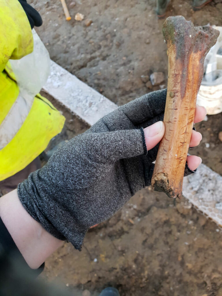
These two tracts of previously undeveloped arable land and pasture were found to hold a wealth of fascinating archaeological finds and features, which, together with the discovery of human remains, paint a vivid picture of how people lived and died and how they settled into and changed their landscape over time.
Generously funded by our client, BA’s team of specialists were able to study and interpret the evidence as it came off site to build a detailed picture of past human behaviour, from occasional visiting by mobile groups in prehistory to more intensive settlement and land management during a long period of Iron Age and Romano-British occupation, subsequent abandonment and reuse several centuries later by the Anglo-Saxons.
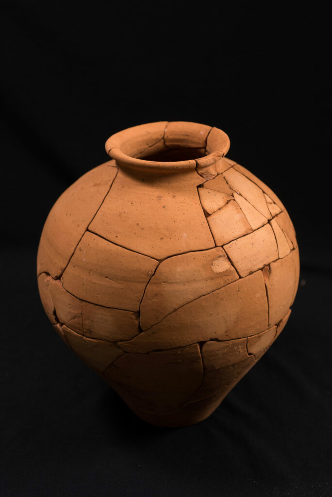
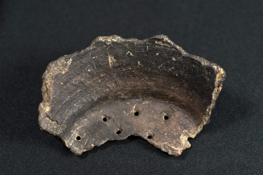
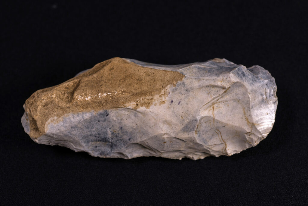
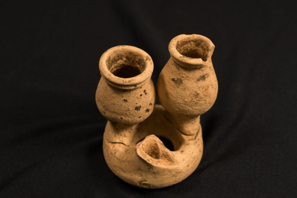
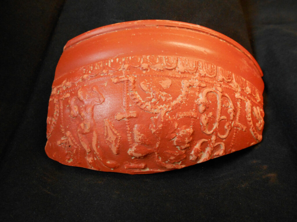
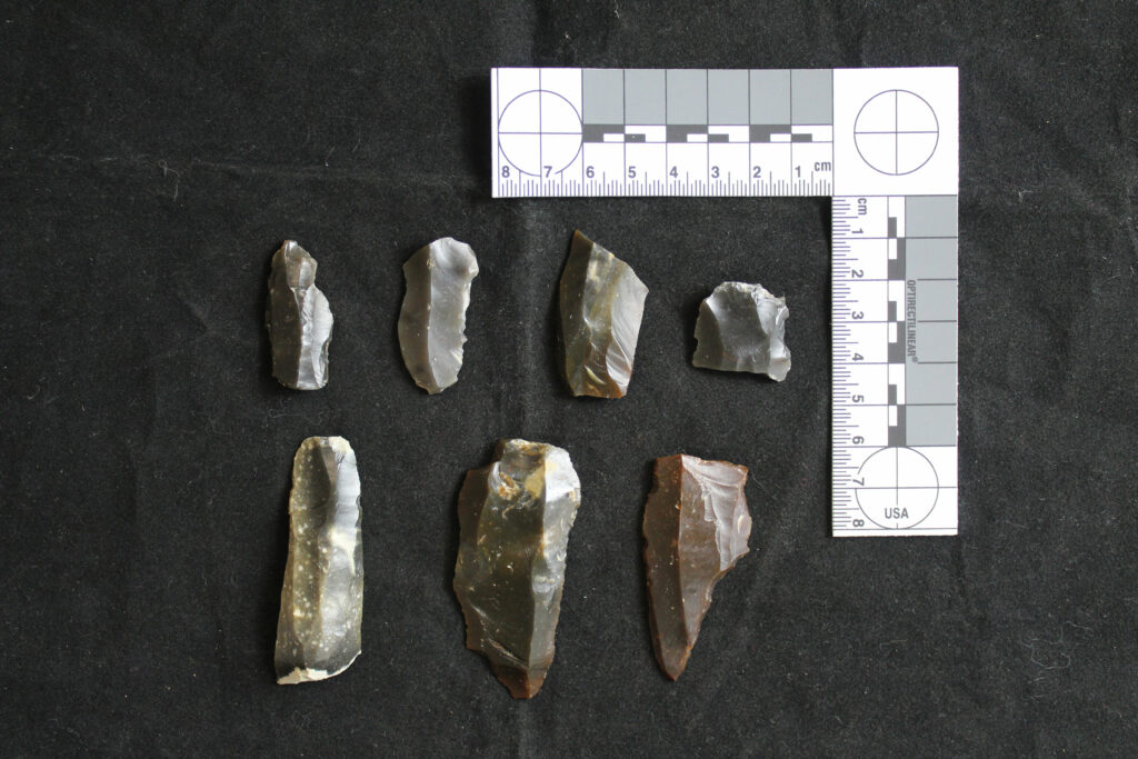
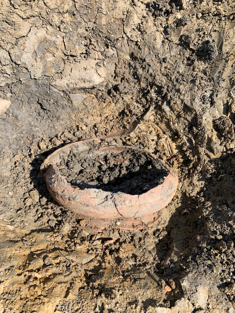
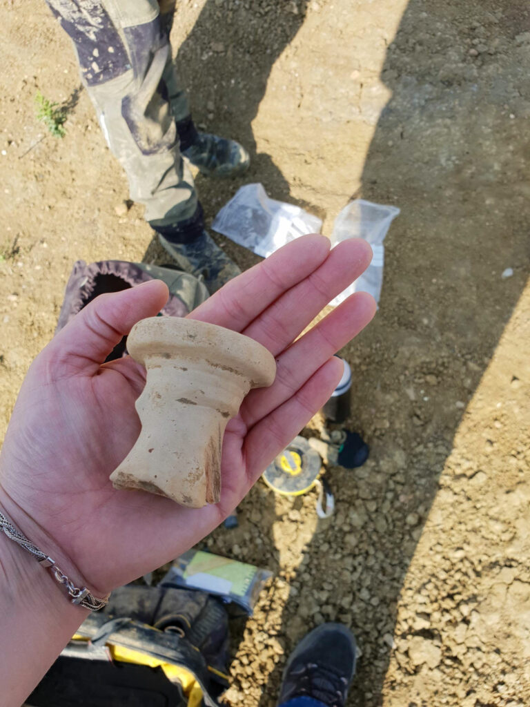
Much of the evidence unearthed related to Iron Age and Roman occupation and cast very significant light on this key transitional period. Discoveries included multiple roundhouses and drove-ways, stock enclosures and extensive field systems with water management features that included wells and ditches. Items of everyday life included a vast assemblage of pottery spanning a broad date range peaking in the 2nd-4th century AD, together with such domestic items as rotary querns for grinding corn and pits containing animal bone and pottery. Just a few finds of prehistoric flintwork were recovered, including a Mesolithic tranchet adze found at Eagle Farm North in the EEA.
Conversion of the land to agricultural use appears to have been underway by the mid to late Iron Age and continued into the 1st century AD transforming a landscape of light woodland to one of managed pasture. Settlement features included roundhouses and/or animal enclosures/windbreaks together with pits and pottery, wells, industrial remains and much more.
At Calverton, in the WEA, adjacent to an arterial roadway whose Roman name has been lost but which is today recognized as Watling Street. Eight roundhouses dating from the middle Iron Age to the early Roman period were unearthed, together with four enclosures, several pits and other features, some overlying each other. Food preferences were clearly illustrated by the animal bones people had left behind, which included cattle, sheep/goat and pig bone with evidence also of horse and red deer during the middle Iron Age. Pottery sherds largely consisting of everyday utilitarian wares made of local clays and dating to the mid to late Iron Age, with only a small percentage identified as being Roman and regionally imported.
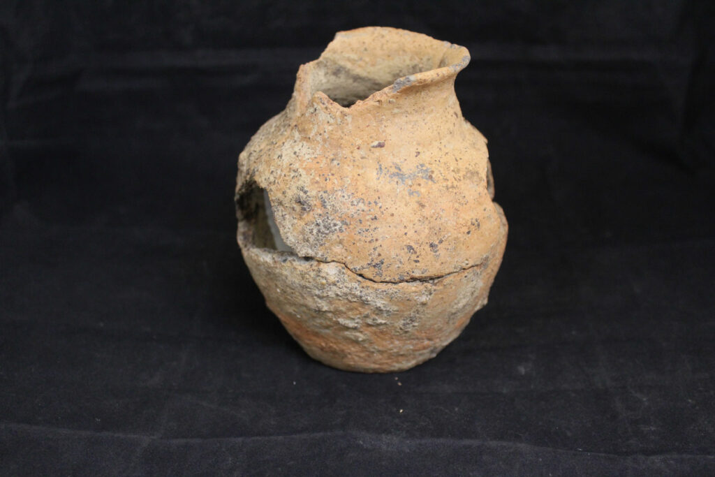
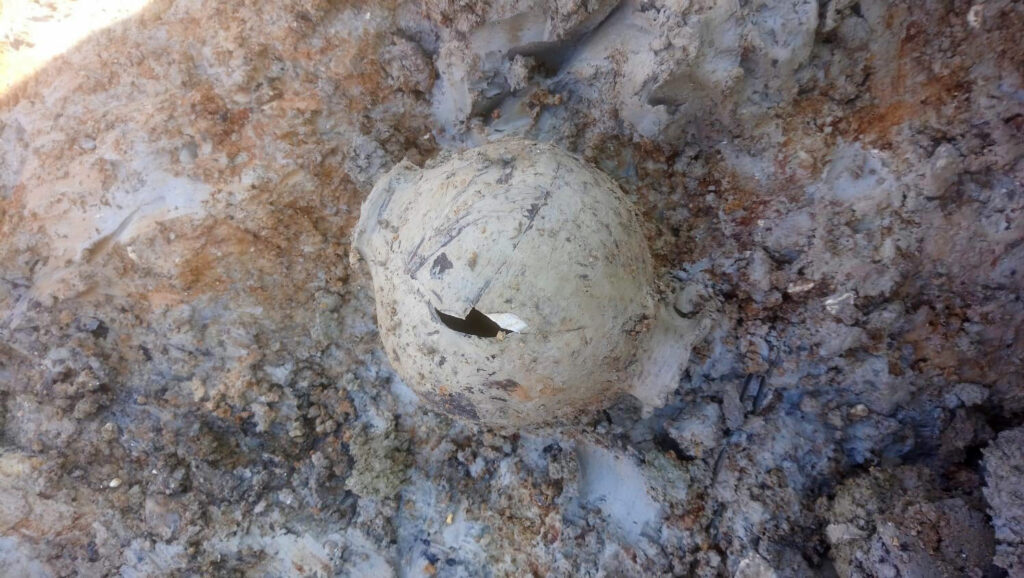
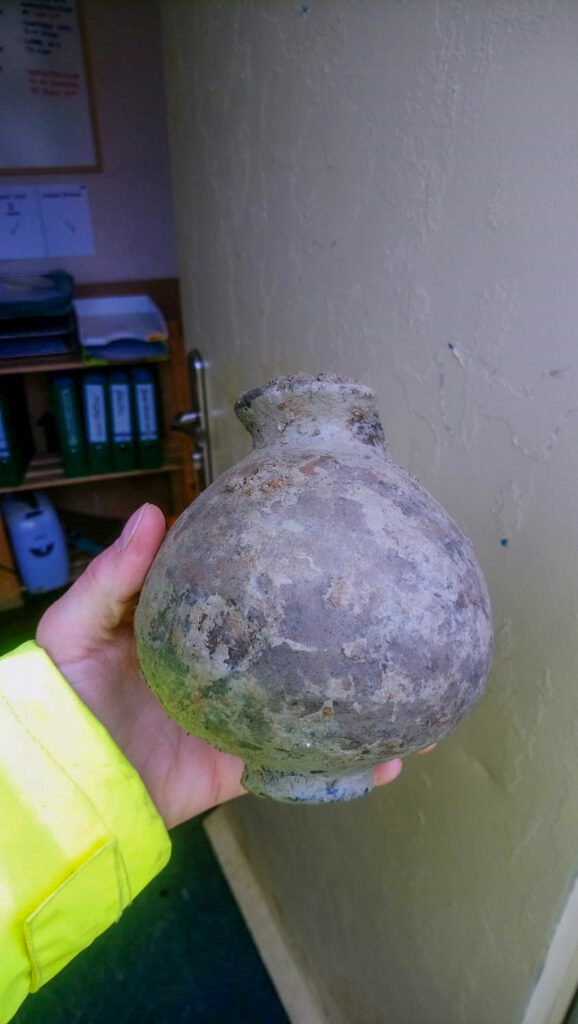
A Romano-British pastoral landscape, which was revealed in a second location at Calverton, included metaled and stone surfaces, a circular stone-laid path, wells, two large ponds, a probable stone lined ‘retting’ pit for linen production and a section of stone wall. One of four wells found contained a timber and stone revetment and another yielded up a short flight of well-preserved wooden steps held in position by charred stakes and flagstones. Astonishingly, the waterlogged conditions had also preserved wooden well-machinery and examples of complete ceramic vessels and one of the two ponds contained a preserved wattle hurdle that suggested fish stock management.
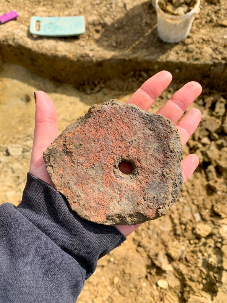
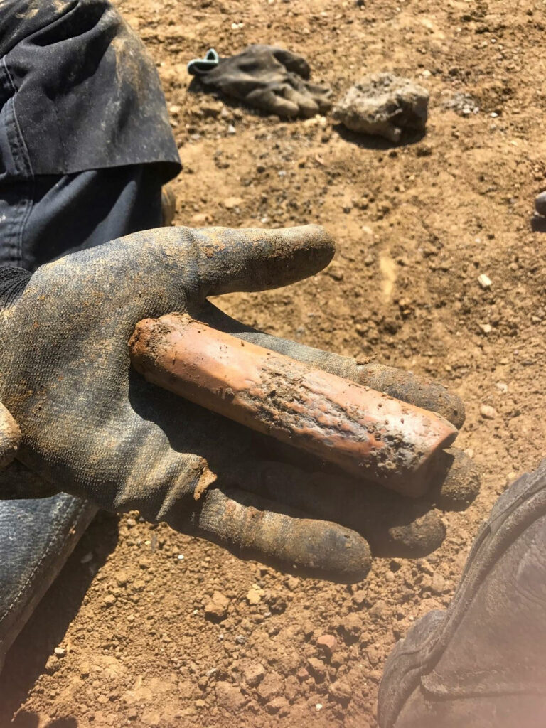
Some evidence was found for grain-processing such as a fragment of a rotary quern but very few cereal remains were present, suggesting a reliance on neighbouring producer sites for the provision of grain. Access to more distant sources is also implied, the Old Red Sandstone from which the quernstone is fashioned probably deriving either from the Forest of Dean or the Wye Valley and strongly suggesting trade links with present-day Herefordshire and/or Gloucestershire.
Once established, this pastoral landscape exhibited a varied pattern of management, with the most intensive activity spanning from the 2nd century AD to the 4th century AD with different land use phases following one another in fairly rapid succession in some area whilst others, by contrast, revealed relatively few land use phases and by the end of the 2nd century AD had been abandoned. This was particularly clear at Eagle Farm North in the EEA, adjacent to the M1 motorway and north of the A421, where we oversaw the installment of haul roads as well as dealing with landscape-scale archaeology,.
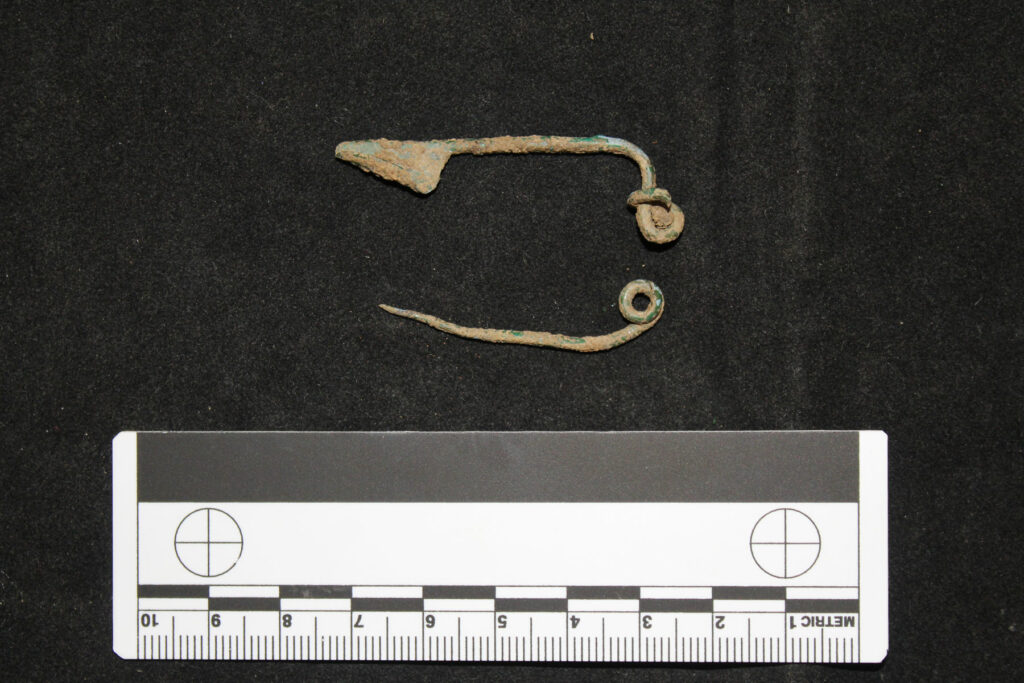
The discovery of Roman burials on both the western and eastern side of the city attests to a sense of permanence – of settling-in and belonging. Although some of the interments consisted of only one or several graves representing small, kin-based unit with no evidence of formal layout to suggest they were part of a larger cemetery, at Glebe Farm, in the EEA, the remains of a cremation cemetery were uncovered containing a total of 13 burials and which appears to have remained in use over an extended period of time.
By the 3rd century AD, droveways had come to dominate much of the landscape signaling a major shift away from localised land management to a more centralised, estate-based system.
Thereafter, whilst activity persisted into the 4th century AD in some areas, the picture is generally one of decline and eventual abandonment, with no further activity attested archaeologically until the medieval period when this entire area came under the plough thereby providing the earliest evidence for arable cultivation.
But the story does not end there, at least on the western side of the city… From the 3rd to 4th centuries AD, the Romans began a gradual withdrawal as conditions within the empire deteriorated. Lacking any kind of management, much of the land reverted to wildwood and scrub and all evidence of human involvement vanished.
However, a new group of people, the Anglo-Saxons, arrived in about 600AD and made the landscape their own whilst respecting those who had gone before and their engineering skills embodied in the paved Roman road which they named Wætling Stræt’. Although no evidence of settlement was found, we unearthed three human burials in the northwest corner of the WEA which formed the southern extent of a larger cemetery. The bodies had been interred on an east-west alignment according to Chistian tradition and two individuals were buried with grave goods. Clearly, this remained a landscape inhabited both by the living and the dead.
Results
In what amounted to the largest single archaeological project undertaken in or around the modern city, our client – a leading UK strategic land company – handed us management responsibility for two council designated urban expansion areas, the MK Western (WEA) and Eastern (EEA) Expansion Areas, respectively, which included individual sites of up to 500,000 square metres.